
Who we are
The Stanford Planning Group is a small team of independent specialists in environmental planning, landscape architecture, urban design and heritage. None of them has a business interest in the village centre. They advise Stanford Conservation and the municipality on how Stanford grows.
Recent work
In February 2025, the group gave its opinion on live entertainment and parking in the village. Its point was that Stanford's Heritage Protection Overlay Zone allows parking rules to be relaxed to protect the historic streetscape. A small, walkable village with shared parking doesn't need car parks that would leave streets empty after hours. The opinion supports the Village Plan's aims of wider sidewalks, three small piazzas, street trees and a lively village centre.
Stanford Conservation came up with the Stanford Village Plan (2014) together with the Stanford Tourism & Business Association and the Stanford Ratepayers Association. The community drew it up in 2014. Overstrand Municipality accepted it in principle, and since 2016 it has been part of the municipal IDP, which means municipal and outside funding can be used for it.
The plan has four focus areas:
- Queen Victoria Street. A main road that is friendlier to walk along, small squares, and a better village entrance as part of the R43 upgrade. See the village entrance below.
- Village Green. One of South Africa's few remaining undeveloped market squares. The two roads around the green have been paved, and the Square hosts the Saturday morning market. See the Market Square Revitalisation page.
- River corridor. The Mill Stream carries the overflow of the natural spring, Stanford's main water source. The plan is to clean the water, remove invasive plants and open the banks for recreation. Once a divide under apartheid, the corridor can now bring the village together.
- Community Centre. A hub for small business, tourism and sport across cultures, linking the sports fields, Community Hall and picnic area to the river.
For news on current progress, email admin@stanfordconservation.org.
The village entrance
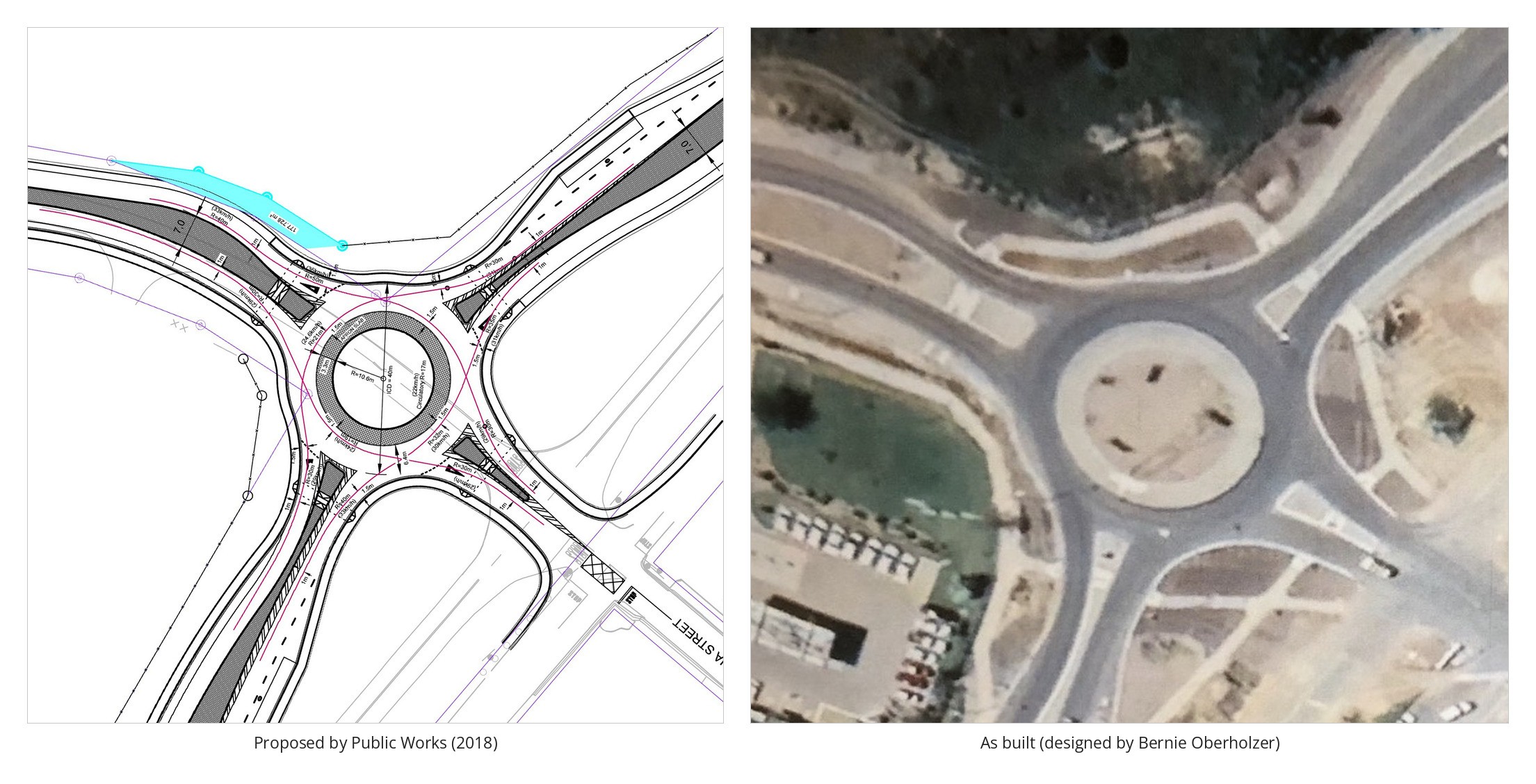
The Village Plan calls for a better village entrance as part of the R43 upgrade. The comparison shows the 2018 Public Works proposal against the circle we have today, designed by Bernie Oberholzer.
The circle is part of the Tree Nursery & Greening initiative, which looks after the gardens at the R43 circle.
Stanford East Precinct Plan
Stanford East, the land east of the R43, is a rare chance to plan a whole new part of the village from scratch. Together with the Heritage Committee, we have drawn up a precinct plan for Stanford East, a local spatial development framework, which has gone to Overstrand Municipality for feedback. It should show how roads, open space, walking routes and community facilities fit together, including the Mill Stream Nature Reserve, before any land there is developed piece by piece.
The Stanford Village Plan (2014)
Together with other village organisations, we drew up a shared vision for upgrading Stanford. Its aims are a welcoming gateway to the village, streets made for people, good public spaces and a lively village heart with a market.
The Mill Stream Village Park & Greenway Concept Master Plan (August 2018, PDF) · Mill Stream project page →
Interested in learning more about the Planning Group? Email us.
Stanford needs you.
Join for R400 per family a year, volunteer an hour or a skill, or make a donation.